Category: Nature

自然

  • Mount Daisen Winter Guide: Snowshoeing, Temples & Nature in Tottori

    Mount Daisen Winter Guide: Snowshoeing, Temples & Nature in Tottori

    Mount Daisen in Tottori Prefecture is a winter wonderland, offering a unique blend of natural beauty and cultural heritage. As the highest peak in the Chugoku region, it provides a perfect escape for those seeking snow-covered landscapes and serene experiences.

    Winter scene on Mount Daisen with snowshoeing travelers, distant temple, and snowy beech forest in bright daylight.
    AI生成イメージ / AI-generated illustration (not a photograph of the actual place)

    Introduction to Mount Daisen: Chugoku’s Highest Peak

    FACT: The Majestic Height of Mount Daisen

    Standing at 1,709 meters, Mount Daisen is the tallest mountain in the Chugoku region. Its imposing presence is not only a geographical landmark but also a cultural one. The mountain is part of the Daisen-Oki National Park, which is renowned for its diverse ecosystems and stunning vistas. In winter, the mountain is blanketed in snow, transforming into a picturesque landscape ideal for winter sports and nature walks. The snow-covered peaks and the surrounding forests create a breathtaking view that attracts visitors from across Japan and beyond.

    FACT: Daisen-Oki National Park’s Winter Wonderland

    The Daisen-Oki National Park, which encompasses Mount Daisen, is a protected area that showcases a rich variety of flora and fauna. During the winter months, the park becomes a haven for those seeking tranquility and the beauty of untouched nature. The park’s trails offer opportunities for snowshoeing and cross-country skiing, allowing visitors to immerse themselves in the serene winter environment. The park’s management ensures that the natural beauty is preserved, making it a pristine location for nature enthusiasts.

    Winter Adventures: Snowshoeing and Skiing in Daisen-Oki National Park

    FACT: Activities for Winter Enthusiasts

    Mount Daisen offers a variety of winter activities that attract outdoor enthusiasts. The Daisen White Resort, located on the northern slopes, provides excellent skiing opportunities with slopes suitable for all skill levels. The resort is well-equipped with modern facilities, including ski rentals and ski schools, making it accessible for beginners and seasoned skiers alike. Snowshoeing through the mountain’s expansive beech forests is another popular activity, offering a peaceful way to explore the snowy terrain and enjoy panoramic views of the Sea of Japan.

    FACT: Exploring the Beech Forests on Snowshoes

    The beech forests of Mount Daisen are a hallmark of the region’s natural beauty. In winter, these forests are covered in a blanket of snow, creating a serene and otherworldly atmosphere. Snowshoeing through these forests provides a unique opportunity to witness the quiet beauty of the winter landscape. The trails wind through the forest, offering glimpses of wildlife and the chance to see the intricate patterns of snow-covered branches. For photographers and nature lovers, the beech forests offer a stunning setting for capturing the essence of winter.

    Mount Daisen 2015-05-03 (17214768368) - Views from Daisen (mountain), Mountaineering in Daisen (mountain)
    “Mount Daisen 2015-05-03 (17214768368)” (Views from Daisen (mountain), Mountaineering in Daisen (mountain)) by hiroaki, CC BY 2.0, source, via Wikimedia Commons

    Pristine Beech Forests and Winter Landscapes

    FACT: The Beauty of Daisen’s Natural Environment

    The beech forests of Mount Daisen are a hallmark of the region’s natural beauty. In winter, these forests are covered in a blanket of snow, creating a serene and otherworldly atmosphere. The area is home to diverse wildlife, and the snow-covered trees provide a stunning backdrop for photography and quiet reflection. The forests are part of a larger ecosystem that supports various species, making it an important area for conservation efforts.

    FACT: Wildlife in the Winter Forests

    Despite the cold, the forests remain alive with wildlife. Visitors may spot deer, foxes, and various bird species adapted to the winter climate. The snow enhances the visibility of animal tracks, providing clues to the unseen life that thrives in this winter wonderland. This interaction with nature offers a deeper understanding of the delicate balance within the ecosystem.

    Walking the Historic Stone-Paved Path to Daisen-ji Temple

    FACT: A Journey Through History

    Daisen-ji Temple, located on the slopes of Mount Daisen, is a significant cultural site with a history dating back over 1,300 years. The temple is accessible via a historic stone-paved path, which offers a glimpse into the region’s past. Walking this path in winter, with snow gently falling around, adds a mystical element to the experience, connecting visitors to the spiritual heritage of the area. The path itself is a testament to ancient craftsmanship, winding through the forest and offering views of the surrounding landscape.

    FACT: The Cultural Significance of Daisen-ji Temple

    Daisen-ji Temple is not only a place of worship but also a cultural treasure. It has been a center of religious activity for centuries, attracting pilgrims and visitors alike. The temple complex includes several buildings and statues, each with its own historical significance. Visitors can explore the temple grounds, learning about the traditions and rituals that have been preserved over the centuries.

    Mount Daisen 2015-05-03 (17214842610) - Mountaineering in Daisen (mountain)
    “Mount Daisen 2015-05-03 (17214842610)” (Mountaineering in Daisen (mountain)) by hiroaki from Tokyo, Japan, CC BY 2.0, source, via Wikimedia Commons

    Mystical Winter Atmospheres: Jizo Sculptures and Sacred Sites

    FACT: Spiritual Significance and Sacred Sculptures

    The area around Daisen-ji Temple is dotted with Jizo sculptures, which are believed to protect travelers and children. These stone statues, often adorned with red bibs, take on a particularly enchanting appearance in winter, surrounded by snow. The temple and its surroundings offer a tranquil space for reflection and spiritual connection, enhanced by the serene winter landscape. The Jizo statues are an integral part of the local spiritual culture, symbolizing protection and benevolence.

    FACT: The Enchanting Presence of Jizo in Winter

    In the quiet of winter, the Jizo statues seem to come alive, their serene expressions offering comfort and peace to those who visit. The red bibs stand out against the white snow, creating a striking visual contrast. For many, visiting these statues is a spiritual journey, a moment to pause and reflect amidst the beauty of nature.

    Savoring Local Flavor: Traditional Daisen Okowa

    FACT: A Taste of Tottori’s Culinary Heritage

    Daisen okowa, a traditional rice dish, is a must-try for visitors to the region. Made with glutinous rice and locally sourced ingredients, it reflects the culinary traditions of Tottori. The dish is often enjoyed at local eateries around Daisen-ji Temple, providing a delicious way to experience the region’s culture and hospitality. The preparation of Daisen okowa is an art in itself, with each ingredient carefully selected to enhance the flavor and texture of the dish.

    FACT: Enjoying Daisen Okowa in Local Eateries

    Local eateries around Daisen-ji Temple offer a variety of dishes that showcase the region’s culinary heritage. Visitors can enjoy Daisen okowa alongside other local specialties, such as fresh seafood from the Sea of Japan. These meals provide a taste of the region’s rich culinary traditions, offering a warm and satisfying experience after a day of exploring the winter landscapes.

    Nearby Guide

    Access

    • Yonago Station (Yonago) — From Yonago Station, take a bus to Daisen-ji Temple. The journey takes approximately 50 minutes. Alternatively, drive via the Yonago Expressway to Yonago IC, then follow the Daisen Kanko Doro road for about 15 minutes to reach the temple area. official site

    Nearby sights

    • Mt. Daisen (Daisen) — Mt. Daisen, standing at 1,709 meters, is the highest peak in the Chugoku region. In winter, it transforms into a snow-covered landscape, offering opportunities for skiing and snowshoeing. The mountain is renowned for its expansive beech forests and panoramic views of the Sea of Japan. official site

    Where to stay

    • Daisen White Resort (Daisen) — Daisen White Resort is a ski resort located on the northern slopes of Mt. Daisen. It offers a range of slopes suitable for all levels, from beginners to advanced skiers. The resort provides equipment rentals and ski schools, making it a convenient base for winter sports enthusiasts. official site

    Where to eat

    • Local Cuisine at Daisen-ji Temple Area (Daisen) — The area around Daisen-ji Temple offers various eateries where visitors can enjoy local specialties. These include dishes made with fresh seafood from the Sea of Japan and locally sourced ingredients, providing a taste of the region’s culinary heritage. official site
    Locator map of Japan: Daisen, Tottori
    Legend site: Daisen, Tottori — Source: Map of Japan with highlight on 31 Tottori prefecture.svg; Map: Lincun, CC BY-SA 3.0, via Wikimedia Commons

    Sources

    About the author

    JAPAN ESSENCE Editorial Team
    Our mission is to bring you Japan’s legends, myths, festivals and living traditions, through both historical fact and the stories passed down over generations.

  • Lake Kussharo Hokkaido: The Legend of Kussie and Ainu Heritage

    Lake Kussharo Hokkaido: The Legend of Kussie and Ainu Heritage

    In the serene landscapes of Hokkaido, Lake Kussharo in Teshikaga is not only Japan’s largest caldera lake but also a place rich in Ainu heritage and local lore. Visitors are drawn to its tranquil waters and to the modern tale of Kussie, the lake’s famous unconfirmed “monster.” In this article we label verified facts, recorded legends, and modern tales separately, with sources.

    Amemasu emerges from Lake Kussharo in a luminous, warm watercolour scene.
    AI生成イメージ / AI-generated illustration (not a photograph of the actual place)

    Introduction to Lake Kussharo: Japan’s Largest Caldera Lake

    FACT: Geographic and Natural Features

    Lake Kussharo lies in Teshikaga, eastern Hokkaido, within Akan-Mashu National Park (designated in 1934 as part of Akan National Park and renamed in 2017). It is Japan’s largest caldera lake by surface area (about 79 km², shoreline about 57 km) and the largest lake in Japan that freezes over completely in winter. The lake sits inside the Kussharo caldera, about 26 km east–west, and the lake itself took shape roughly 30,000 years ago. Its name comes from the Ainu word kutchar, “throat,” meaning the outlet where the lake drains into a river; the lake’s outflow is the Kushiro River (Wikipedia (JA): 屈斜路湖; Wikipedia: Lake Kussharo).

    Because the area is volcanic, hot springs rise along the shore and even from the lake bed. In winter, whooper swans from Siberia gather where warm water keeps the shore free of ice. Nakajima, the island in the middle of the lake, is Japan’s largest island in a lake (about 5.7 km², highest point 355 m) (Wikipedia (JA)).

    Important: Nakajima can be viewed from the shore or from the water, but landing on the island is prohibited (上陸禁止). Under the Lake Kussharo usage rules published by Teshikaga Town, landing on Nakajima is restricted to protect its primeval forest ecosystem and other valuable natural environment. The same manual also describes past boating accidents caused by strong winds, so check the weather and wear a life jacket on the water (Teshikaga Town, Lake Kussharo Rules & Safety Manual (PDF)).

    Lake Spirits in Ainu Tradition: The Giant Amemasu and Other Tales

    LEGEND: Recorded Ainu Tales of the Lake

    Accounts drawn from the published literature record Ainu legends of a giant snake living in Lake Kussharo (one tale says it swallowed a deer whole), as well as legends of a giant amemasu (white-spotted char) or itō (Sakhalin taimen) living in the lake. One story also tells how settlers from Honshu who arrived in the Meiji era were warned by local Ainu about the lake’s nushi (guardian spirit): if they saw it, they should tell no one, or misfortune would follow. Settlers are said to have feared earthquakes as the nushi‘s curse (Wikipedia (JA): クッシー, “言い伝え” section, citing 宇留島進 1993).

    These are told as legends, not as historical events, and published versions differ in their details. Elaborate interpretations you may see online, such as fixed rules about what angers the creature, are not confirmed by the sources we checked, so we do not repeat them here. To learn about Ainu oral literature (yukar) firsthand, visit the Kussharo Kotan Ainu Museum described below.

    130713 Lake Kussharo Teshikaga Hokkaido Japan01s5 - Lake Kussharo, Aerial photographs of Hokkaido
    “130713 Lake Kussharo Teshikaga Hokkaido Japan01s5” (Lake Kussharo, Aerial photographs of Hokkaido) by 663highland, CC BY 2.5, source, via Wikimedia Commons

    Kussie: Hokkaido’s Famous Lake Kussharo Monster

    MODERN TALE: Kussie Sightings (UMA)

    Kussie (クッシー) is a modern cryptid, or UMA, named after Scotland’s “Nessie.” It is not an Ainu tradition. A driver reported an unusual object in November 1972, and the story became famous after a group of about 40 junior high school students said they saw a creature in August 1973 while on a school trip to Mt. Mokoto. Photos of ripples and objects followed in the 1970s, but none has been verified, and reports have almost stopped since the 2000s (Wikipedia (JA): クッシー; Wikipedia (JA): 屈斜路湖).

    FACT / SPECULATION: What Science Says

    Skeptics point out that the 1938 Kussharo earthquake released sulfur from the lake bed and turned the water strongly acidic (around pH 4), wiping out most fish. That leaves little food for a large animal, so its existence is considered very unlikely. Suggested explanations include large fish (amemasu or itō) or misidentified boats. Locals also say that omiwatari ice ridges, which form when lake ice cracks and pushes up into snake-like lines, are “Kussie’s doing.” Some writers suggest the Ainu snake legend may have been inspired by the same phenomenon (Wikipedia (JA): クッシー). Today a Kussie statue stands on the lakeshore, and the creature has become a lighthearted local mascot and a draw for tourists.

    Preserving Heritage at the Kussharo Kotan Ainu Museum

    FACT: Ainu Culture and History

    The Teshikaga Town Kussharo Kotan Ainu Museum opened on June 6, 1982, on the southern shore of Lake Kussharo to pass on the history and culture of the Ainu. Its exhibits are organized around five themes: the forest of yukar (Ainu oral epics), the land of the kotan (village), how the kotan has changed, life in the hills and fields, and the people who support the kotan. In 2020 its name was changed from “Ainu Folklore Museum” to “Ainu Museum” (Teshikaga Town official site; Hokkaido Digital Museum).

    Hands-on programs listed by the town include Ainu-pattern embroidery (a coaster, ¥1,000, about 120 minutes), magatama bead making (¥700), and free try-ons of traditional Ainu clothing. The embroidery and magatama programs need a phone reservation at least 3 days ahead (tel. 015-484-2128). The museum also screens a shortened version of a film recording a 1986 Chironnupu Kamui Iomante (fox spirit-sending) ceremony (Teshikaga Town official site).

    Lake Kussharo banner - Lake Kussharo, Aerial photographs of Hokkaido
    “Lake Kussharo banner” (Lake Kussharo, Aerial photographs of Hokkaido) by 663highland, cropped by Tmv, CC BY 2.5, source, via Wikimedia Commons

    Experiencing Sunayu: Natural Hot Sand Baths on the Shore

    FACT: Unique Onsen Experience

    At Sunayu (砂湯), on the eastern shore, hot spring water wells up when you dig into the beach sand, so visitors can make their own small open-air foot bath (Wikipedia (JA)). According to the Lake Mashu Tourism Association, the spring water is a sodium-bicarbonate type. Geothermal heat keeps this part of the shore from freezing even in deep winter, which is why whooper swans rest here. The site is open 24 hours with no admission fee, and there is a campground and a rest house nearby (摩周湖観光協会 (Lake Mashu Tourism Association): 砂湯).

    Safety notes: the water can be very hot in places, so test it with your hand first and watch children closely. Sunayu is a natural shoreline, not a staffed bathhouse, so bring a towel and follow posted signs.

    Planning Your Visit to Lake Kussharo in Eastern Hokkaido

    FACT: Travel Tips and Access (checked October 2026)

    A car is the most practical way to tour the lake. Public transport in the area is limited, so check current routes and timetables before you go. Kussharo Kotan Ainu Museum: In fiscal 2026 the museum is open daily from April 10 to November 30, 9:00–17:00 (last entry 16:30), and closed in winter. Admission is ¥420 for adults and ¥280 for elementary and junior high school students (Teshikaga Town; Hokkaido Digital Museum). Hours and fees can change, so confirm them before your visit.

    Safety and rules: Landing on Nakajima is prohibited. Weather on the lake changes quickly, and strong winds have caused boating accidents in the past, so check the forecast and wear a life jacket for canoeing or boating (Teshikaga Town rules & safety manual). Winters are severe, and the lake usually freezes from around December to March. Brown bears live in eastern Hokkaido, so follow local guidance when walking in forests.

    Locator map of Japan: Teshikaga, Hokkaido
    Legend site: Teshikaga, Hokkaido — Source: Map of Japan with highlight on 01 Hokkaido prefecture.svg; Map: Lincun, CC BY-SA 3.0, via Wikimedia Commons

    Regional guide

    Location: Teshikaga, Hokkaido Prefecture

    • Kussharo Kotan Ainu Museum (Teshikaga) — source

    Sources

    About the author

    JAPAN ESSENCE Editorial Team
    Our mission is to bring you Japan’s legends, myths, festivals and living traditions, through both historical fact and the stories passed down over generations.

  • Autumn at Keishun-in: Kyoto’s Lantern-Lit Garden and the Story of Momijigari

    Autumn at Keishun-in: Kyoto’s Lantern-Lit Garden and the Story of Momijigari

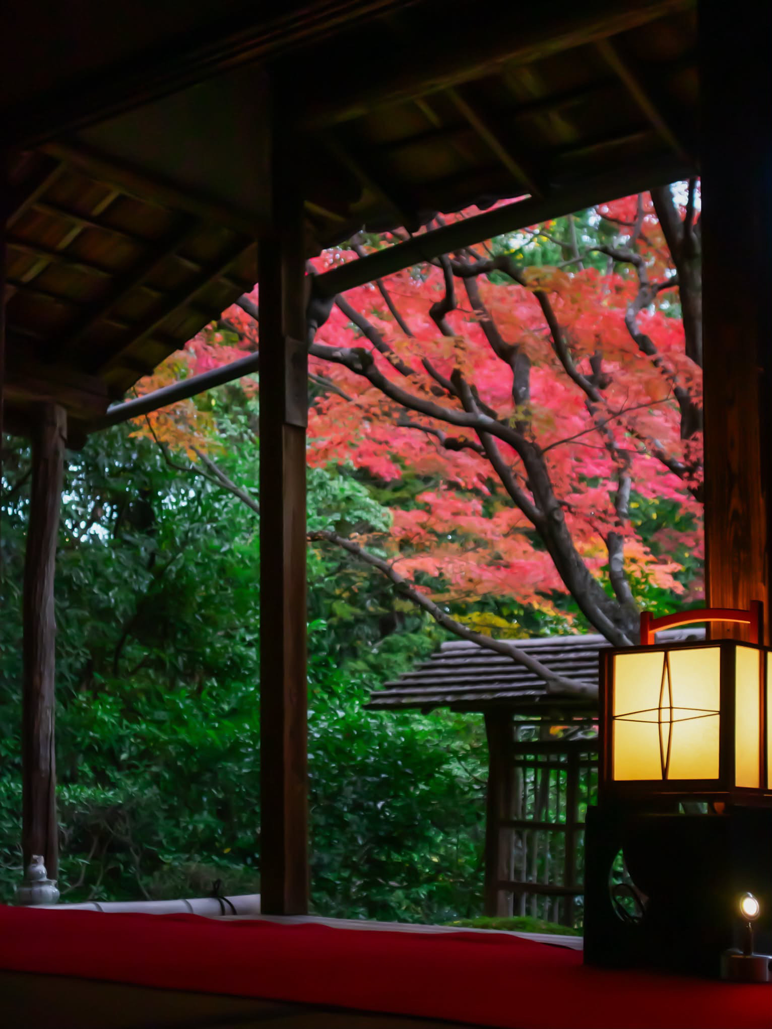
    Autumn maple leaves and a glowing lantern beside the veranda at Keishun-in, Kyoto
    Keishun-in, Myoshinji, Kyoto. Photo courtesy of the JAPAN ESSENCE site owner (shooting date unknown).

    Scarlet maple leaves arch over a small roofed gate. Below them, a wall of deep evergreen; in front, dark wooden pillars, a red felt runner along the veranda, and a paper lantern glowing amber in the dusk. This single photograph, shared by the owner of this site, captures what many people travel to Kyoto for in autumn: not a crowd-filled viewpoint, but a quiet moment where color, wood and light meet.

    Where is this? Keishun-in at Myoshinji

    The scene has been identified, with high confidence, as the veranda facing the Wabi Garden (侘の庭) at Keishun-in (桂春院), a sub-temple of Myoshinji in Hanazono, Ukyo Ward, Kyoto. The roofed gate, the shape of the maple branches, the pillars, the red runner and the lantern match published photographs of the temple. (The image file has no GPS or date data, so we do not claim when it was taken.)

    What is a sub-temple? Large Zen head temples in Japan are surrounded by smaller temples within or beside their precincts, called tatchū (塔頭, sub-temples). Each has its own buildings, gardens and history. Myoshinji, head temple of the Myoshinji branch of Rinzai Zen, has many; Keishun-in is one of the few open to visitors all year. (Keishun-in official)

    History (from the temple’s official site): Keishun-in was founded in the Azuchi-Momoyama period by Tsuda Hidenori, a grandson of Oda Nobunaga; the temple’s official pages give the year as 1598. It was later revived by Ishikawa Sadamasa, who served both Toyotomi Hideyoshi and Tokugawa Ieyasu. The temple says its study hall (shoin) was moved here from Nagahama Castle, and that its buildings and interiors have kept their form for about 400 years. Some tourism pages give different founders or dates; we follow the temple. Its front gate, main hall and study hall are Kyoto Prefecture Tangible Cultural Properties, and its gardens are a nationally designated Place of Scenic Beauty and Historic Site. (Keishun-in official / official special-program page)

    The four gardens

    The temple attributes its four gardens to Gyokuenbō, a monk-gardener and disciple of the tea master Kobori Enshū. Each shows a different scene; the temple itself describes them together as the path of a trainee toward awakening, which we report as the temple’s own interpretation. Per the official garden page (Garden history):

    • Seijō no Niwa (清浄の庭) — a small courtyard dry garden north of the main hall, with a stone-arranged waterfall and a stream of white sand.
    • Wabi no Niwa (侘びの庭) — the garden in our photo. It is a roji (tea-garden path) leading from the study hall to the hidden tea room Kihaku-an (既白庵). The Baiken-mon gate and a saru-do wicket divide it into inner and outer sections, and a moss-covered stone water basin (tsukubai) sits half hidden.
    • Shii no Niwa (思惟の庭) — east of the main hall; stepping stones lead from the Baiken-mon gate through a roji-like garden with scattered stones.
    • Shinnyo no Niwa (真如の庭) — south of the main hall; maples in front of satsuki and Kirishima azaleas and Japanese andromeda, over a carpet of haircap moss with small stones set in a 7-5-3 style arrangement.

    Kihaku-an tea room: the official site describes Kihaku-an as a place that is normally completely closed to the public. A regular admission ticket does not include entry; the temple has shown it only through separate reserved programs. Ordinary visitors see the gardens from the buildings and veranda. (Keishun-in official)
    Other highlights: inside, you walk through the cultural-property buildings themselves. The official site highlights the gold-leaf sliding-door (fusuma) painting “Pine Trees and Crescent Moon” (金碧松三日月図) by the Edo-period painter Kano Sansetsu, whose works are held by museums abroad, as well as surviving furnishings. Matcha with a seasonal sweet (¥800) can be ordered—a simple way to sit and look at the gardens. (Keishun-in official)

    Why leaves turn red and yellow

    Yellow is already in the leaf: as chlorophyll breaks down in autumn, carotenoid pigments become visible. Red is different—it comes from anthocyanins that the leaf produces in autumn. Sunny days, cold nights and moderate moisture all affect how vivid the color becomes. (National Museum of Nature and Science)

    Momiji or kaede?

    Japanese has two words for these trees. Momiji is explained as coming from the old verb momizu, “to change color” (of leaves). Kaede is explained as coming from kaerude, “frog’s hand,” for the leaf’s shape. The two words overlap heavily rather than naming completely separate plant groups. (Ministry of the Environment, Kinki Regional Office)

    Momijigari: “hunting” without hunting

    Momijigari literally means “autumn-leaf hunting,” but nothing is caught: it means going out to the hills to enjoy the colors, a broadened sense of kari (JNTO). Appreciation of autumn leaves appears in classics such as the Kokin Wakashū and The Tale of Genji, and by the Edo period the custom had spread to ordinary townspeople, as woodblock prints show. It has no single founding date or inventor. (JNTO / National Diet Library)

    Five autumn-leaf spots across Japan

    Note: the periods below are typical-year guides only—not a 2026 forecast or current conditions. Timing changes with weather and altitude. These are separate places from Keishun-in.

    1. Ginsendai, Daisetsuzan (Hokkaido) — usually mid to late September; red and yellow mountainsides against dark conifers. (Visit Hokkaido)
    2. Oirase Gorge (Aomori) — usually late October to early November; a stream, waterfalls and mossy rocks under the leaves. (Aomori Tourism)
    3. Korankei (Aichi) — usually November; maples around Mt. Iimori. (Aichi Now)
    4. Kiyomizu-dera (Kyoto) — Kyoto’s autumn usually centers on mid to late November, varying by year and place. (JNTO / Kyoto City Tourism, typical guide)
    5. Momijidani Park, Miyajima (Hiroshima) — usually November; maples at the foot of Mt. Misen among evergreens. (Miyajima Tourist Association)

    Area guide: visiting Keishun-in

    Address: 11 Hanazono Teranonaka-cho, Ukyo-ku, Kyoto. Access: Randen (Keifuku) Kitano Line, Myoshinji Station; or bus to “Myoshinji Kitamon-mae,” about 5 minutes on foot (Kyoto City Bus 8, 10, 26 or JR Bus from Kyoto Station, per the temple). Hours/fees (as listed on the official site, checked 16 Oct 2026): 9:00–17:00 (winter until 16:30); admission ¥500; matcha with seasonal sweet ¥800. Closures for ceremonies are possible—always check the official site before visiting. No special autumn night opening was found on the official site.

    Manners: stay on the veranda and paths, keep voices low, and follow the temple’s photography rules.

    Nearby: the vast Myoshinji precinct itself; Ryoan-ji with its famous rock garden; and Ninna-ji, a World Heritage temple. Stay: central Kyoto (Shijo/Karasuma) or around Kyoto Station gives easy bus access; see Kyoto City Official Travel Guide. Food: the temple’s own matcha and seasonal sweet is a natural pause; the Hanazono area also has places serving Buddhist vegetarian (shōjin) cuisine.

    Interested in another side of Kyoto craft culture? Visit our sister site Oni Koubou.

    Letting the season turn slowly

    Autumn in Japan is often chased from forecast to forecast. A place like Keishun-in suggests another way: sit at the edge of a veranda, let the lantern warm the corner of your eye, and watch one maple turn. The best view may simply be the one you have time to stay with.

    Sources: Keishun-in official (keishunin.com: top, garden and special-program pages); National Museum of Nature and Science; Ministry of the Environment Kinki Regional Office; JNTO; National Diet Library; Visit Hokkaido; Aomori Tourism; Aichi Now; Kyoto City Tourism; Miyajima Tourist Association. Photo: courtesy of the site owner.

  • Osaka Autumn Food Trails: Seasonal Sweets & Fall Foliage

    Osaka Autumn Food Trails: Seasonal Sweets & Fall Foliage

    Osaka, a bustling metropolis in Osaka Prefecture, transforms into a haven of vibrant colors and flavors during autumn. As the leaves turn, the city offers a unique blend of seasonal delicacies and picturesque landscapes, making it a perfect destination for food and nature enthusiasts alike.

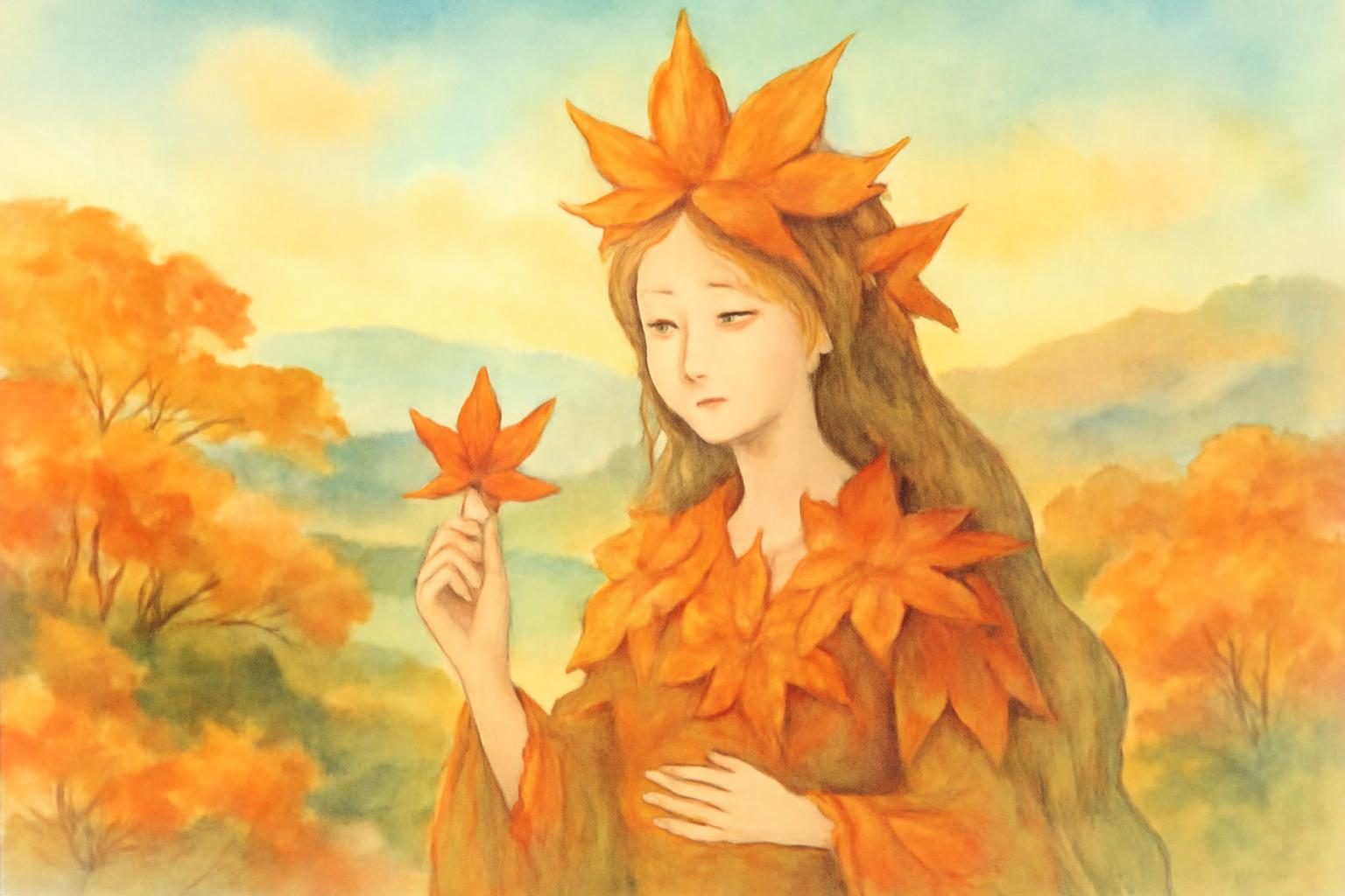
    Mythical kami marvels at a maple leaf in a warm autumn landscape.
    AI生成イメージ / AI-generated illustration (not a photograph of the actual place)

    Introduction to Autumn in Osaka: Foliage Meets Flavor

    FACT: The Charm of Osaka’s Autumn

    Autumn in Osaka is a time when the city bursts into a symphony of red, orange, and yellow hues. The mild weather and stunning fall foliage create an inviting atmosphere for both locals and tourists. This season is also marked by a variety of food festivals and markets that celebrate the region’s rich culinary heritage. Visitors can enjoy the crisp air and vibrant scenery while indulging in seasonal treats that highlight the flavors of autumn.

    As the city embraces the change of seasons, locals and visitors alike find joy in the simple pleasures of autumn. Parks and gardens become lively with people enjoying hanami, or flower viewing, but this time with the colorful leaves instead of cherry blossoms. The city’s many waterways and green spaces provide the perfect backdrop for leisurely strolls and picnics, allowing everyone to savor the beauty of nature alongside the culinary delights that define Osaka’s autumn.

    Minoo Park and the Century-Old Tradition of Momiji Tempura

    FACT: Minoo Park’s Natural Beauty

    Minoo Park, located just north of Osaka City, is renowned for its breathtaking autumn scenery. The park is a popular spot for viewing the vibrant momiji (Japanese maple) leaves. Visitors can enjoy leisurely walks along the park’s trails, taking in the stunning views of the waterfall and the surrounding forest. The park’s natural beauty is complemented by its serene atmosphere, making it an ideal location for a peaceful retreat into nature during the bustling autumn season.

    The park’s trails are well-maintained and offer a variety of routes for hikers of all levels. As you wander through the park, the sound of the Minoo waterfall provides a soothing backdrop, enhancing the tranquil experience. The park is also home to a diverse range of wildlife, and if you’re lucky, you might spot some of the local fauna that inhabit the area. Minoo Park is not just a feast for the eyes but also a place to reconnect with nature and find solace away from the city’s hustle and bustle.

    LEGEND: The Origin of Momiji Tempura

    According to local tradition, the practice of making momiji tempura, a unique snack made by frying maple leaves, originated in the Minoo area. This delicacy is said to have been inspired by the beauty of the autumn leaves, offering a taste that is as delightful as the scenery itself. While the exact origins remain a matter of folklore, momiji tempura continues to be a beloved treat during the fall season. The legend suggests that the vibrant colors of the leaves are captured in the delicate batter, providing a crispy and subtly sweet snack that is as much a feast for the eyes as it is for the palate.

    Visitors to Minoo Park can often find momiji tempura being sold at small stalls along the park’s main path. The process of making this snack involves carefully selecting the most vibrant leaves, which are then coated in a light batter and fried to perfection. The result is a crispy treat that embodies the essence of autumn. This tradition not only highlights the creativity of local cuisine but also serves as a testament to the region’s appreciation for nature’s beauty.

    Osaka Castle Park 20071230 - Remote views of Osaka Castle
    “Osaka Castle Park 20071230” (Remote views of Osaka Castle) by PekePON, CC BY-SA 3.0, source, via Wikimedia Commons

    Osaka Castle Park: Autumn Scenery and Seasonal Food Festivals

    FACT: Yakiimo Fes OSAKA 2026

    One of the highlights of Osaka’s autumn is the Yakiimo Fes OSAKA 2026, held at Taiyo-no-Hiroba within Osaka Castle Park from October 30 to November 8. This festival celebrates the humble sweet potato, offering a variety of dishes that showcase its versatility. With free admission and cashless payment options, it is an accessible event for all. Visitors can sample different preparations of sweet potatoes, from roasted yakiimo to innovative sweet potato desserts, all while enjoying the festive atmosphere.

    The festival not only highlights traditional sweet potato dishes but also encourages culinary innovation. Chefs and vendors experiment with new flavors and techniques, presenting sweet potatoes in ways that surprise and delight. From sweet potato ice cream to savory dishes featuring sweet potato as a key ingredient, the festival offers a diverse range of options that cater to all tastes. It’s an opportunity to explore the potential of this simple ingredient while celebrating its cultural significance in Japanese cuisine.

    FACT: The Splendor of Osaka Castle Park

    Osaka Castle Park is not only a historical landmark but also a prime location for enjoying the fall foliage. The park’s expansive grounds are home to numerous cherry and maple trees, which transform into a sea of vibrant colors in autumn. Visitors can explore the park’s walking paths, enjoy a picnic, or simply relax and take in the stunning views of the castle surrounded by autumn leaves. The juxtaposition of the historic castle with the natural beauty of the season provides a picturesque setting that is perfect for photography and leisurely strolls.

    In addition to its natural beauty, Osaka Castle Park offers various cultural and historical attractions. The castle itself is a symbol of Osaka’s rich history, and visitors can explore its museum to learn more about the region’s past. Seasonal events and performances often take place in the park, adding to the lively atmosphere. Whether you’re a history buff or simply looking to enjoy a day outdoors, the park offers a multifaceted experience that captures the essence of Osaka in autumn.

    Harvest Flavors at Kuromon Ichiba Market

    FACT: A Culinary Journey Through Kuromon Market

    Kuromon Ichiba Market, located in the heart of Osaka, is a must-visit for food lovers. Known as “Osaka’s Kitchen,” the market offers a wide array of fresh produce, seafood, and local delicacies. During autumn, the market is particularly vibrant, with seasonal offerings such as mushrooms, chestnuts, and persimmons. It’s a perfect place to experience the flavors of Osaka and pick up some unique ingredients to try at home. The bustling atmosphere of the market, combined with the rich scents of seasonal ingredients, provides an immersive culinary experience that captures the essence of Osaka’s food culture.

    As you navigate through the market, you’ll encounter a variety of stalls offering everything from traditional Japanese snacks to international cuisine. The market’s lively environment is a reflection of Osaka’s dynamic food scene, where innovation meets tradition. Visitors can sample freshly prepared dishes on-site or purchase ingredients to recreate the flavors at home. Kuromon Ichiba Market is not just a place to shop but an experience that engages all the senses, offering a taste of Osaka’s culinary diversity.

    Dry moat at Osaka Castle Park, September 2017 - Dry Moat (Osaka Castle)
    “Dry moat at Osaka Castle Park, September 2017” (Dry Moat (Osaka Castle)) by Ethmostigmus, CC BY-SA 4.0, source, via Wikimedia Commons

    Planning Your Kansai Autumn Food Itinerary

    FACT: Tips for Enjoying Osaka’s Autumn Delights

    To make the most of your autumn visit to Osaka, consider starting your journey at Minoo Park to enjoy the natural beauty and taste the famous momiji tempura. Then, head to Osaka Castle Park for the Yakiimo Fes and immerse yourself in the vibrant atmosphere of the festival. Finally, explore Kuromon Ichiba Market to discover the rich culinary offerings of the season. Each location offers a unique experience that combines the best of Osaka’s natural and culinary delights. Whether you’re savoring the simple pleasure of a roasted sweet potato or exploring the diverse offerings of a bustling market, Osaka in autumn promises a feast for the senses.

    For those planning a longer stay, consider exploring other nearby attractions and activities that showcase the region’s culture and history. From traditional tea ceremonies to modern art exhibitions, Osaka offers a wealth of experiences that cater to a variety of interests. Be sure to check the official websites for current hours, fees, and access details to ensure a smooth and enjoyable visit.

    Locator map of Japan: Osaka, Osaka
    Legend site: Osaka, Osaka — Source: Map of Japan with highlight on 27 Osaka prefecture.svg; Map: Lincun, CC BY-SA 3.0, via Wikimedia Commons

    Regional guide

    Location: Osaka, Osaka Prefecture

    • Yakiimo Fes (Osaka) — source

    Sources

    About the author

    JAPAN ESSENCE Editorial Team
    Our mission is to bring you Japan’s legends, myths, festivals and living traditions, through both historical fact and the stories passed down over generations.

  • Exploring Lake Kussharo: Hokkaido’s Caldera, Monsters, and Ainu Legends

    Exploring Lake Kussharo: Hokkaido’s Caldera, Monsters, and Ainu Legends

    In Teshikaga, Hokkaido Prefecture, lies Lake Kussharo, a caldera lake steeped in natural beauty and rich folklore. This area, part of the Akan-Mashu National Park, is famed for its stunning landscapes and intriguing legends.

    Lake Kussharo seen from the west, in Teshikaga, Hokkaido Prefecture, Japan.
    “130713 Lake Kussharo Teshikaga Hokkaido Japan01s5” by 663highland, CC BY 2.5, via Wikimedia Commons

    Introduction to Lake Kussharo and Akan-Mashu National Park

    FACT: The Geography of Lake Kussharo

    Lake Kussharo is a caldera lake located in Akan-Mashu National Park in eastern Hokkaido, specifically within the municipality of Teshikaga. It is the largest caldera lake in Japan, formed by volcanic activity, and is surrounded by picturesque mountains and lush forests. The lake’s central island, Nakajima, adds to its scenic allure. Visitors can explore the lake’s vast expanse, which is known for its unique geological features and diverse ecosystems. The surrounding area is a haven for wildlife, providing a habitat for various bird species and other native fauna.

    The lake’s caldera formation is a result of ancient volcanic eruptions, creating a natural basin that has filled with water over time. This geological history contributes to the lake’s unique landscape, with its clear waters reflecting the surrounding peaks and forests. The presence of Nakajima Island in the center of the lake offers a focal point for visitors, enhancing the lake’s picturesque quality. Nakajima can be viewed from the shore or from the lake, but landing on the island is prohibited: under the Lake Kussharo usage rules published by Teshikaga Town, landing on Nakajima is restricted to protect its primeval forest ecosystem and other valuable natural environment (Teshikaga Town, Lake Kussharo Rules & Safety Manual).

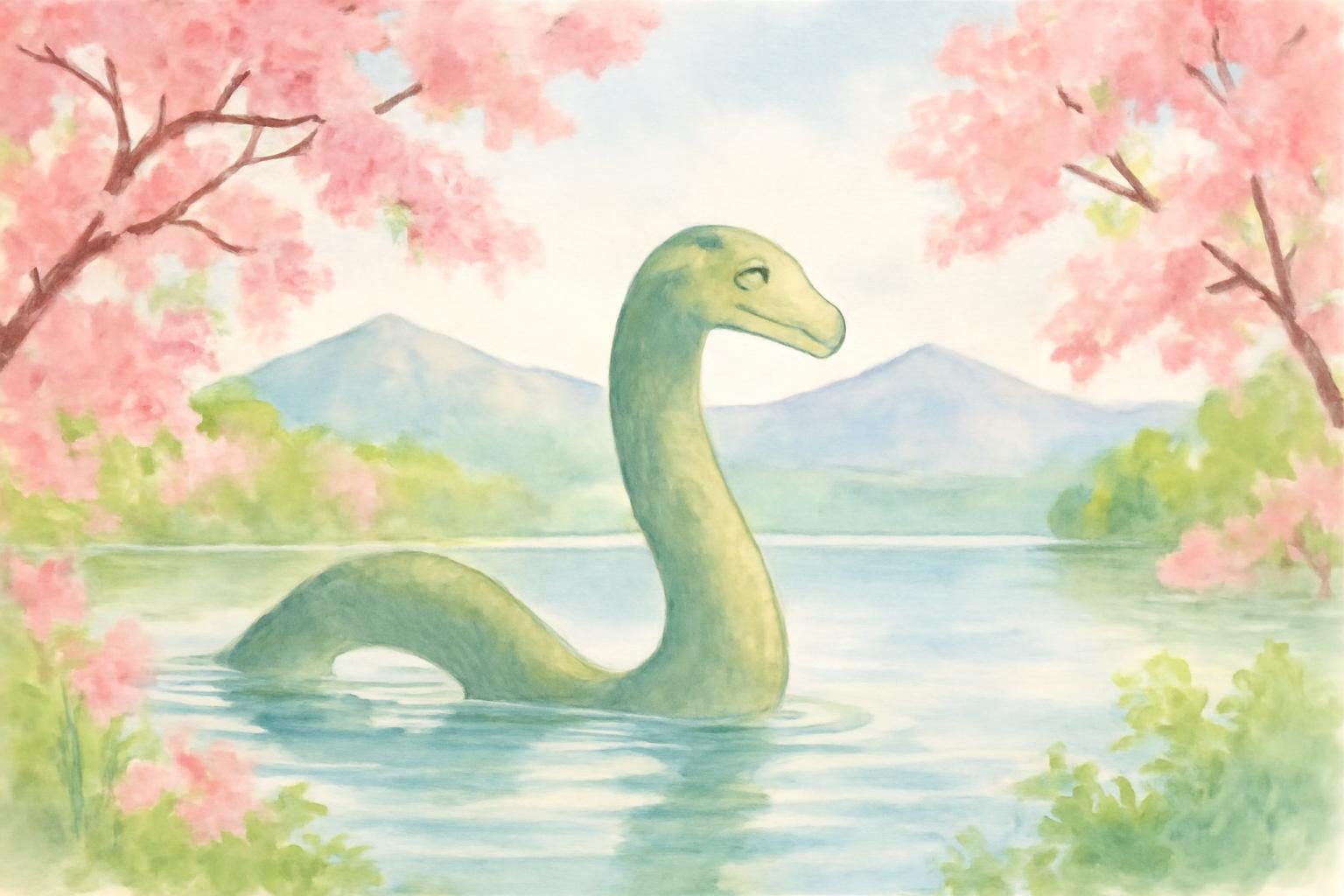
    Kusshii emerging amidst cherry blossoms and mountains at Lake Kussharo in spring.
    AI生成イメージ / AI-generated illustration (not a photograph of the actual place)

    Japan’s Loch Ness: The Legend of Kusshii

    LEGEND: The Mythical Kusshii

    According to local legend, Lake Kussharo is home to a creature known as Kusshii, often compared to Scotland’s Loch Ness Monster. This mythical beast is said to inhabit the depths of the lake, occasionally surfacing to the awe and wonder of onlookers. Stories of Kusshii have been passed down through generations, captivating both locals and visitors with tales of mysterious sightings and unexplained ripples on the lake’s surface. The legend of Kusshii is a fascinating aspect of the local folklore, adding an air of mystery and excitement to the serene beauty of the lake. While scientific evidence of Kusshii’s existence is lacking, the stories continue to fuel the imagination of those who visit.

    Local residents and visitors alike have shared anecdotes of encountering Kusshii, with some claiming to have seen the creature’s long neck and humps breaking the water’s surface. These stories often emerge during foggy mornings or at dusk, when the lake’s atmosphere is most mystical. The legend of Kusshii contributes to the cultural identity of Teshikaga, drawing tourists who are eager to catch a glimpse of the elusive creature. The local tourism industry embraces this folklore, with souvenirs and themed events celebrating the legend of Kusshii.

    屈斜路湖~津別峠 - Lake Kussharo-ko from Tsubetsu-toge - panoramio - Lake Kussharo
    “屈斜路湖~津別峠 – Lake Kussharo-ko from Tsubetsu-toge – panoramio” (Lake Kussharo) by shinohal, CC BY-SA 3.0, source, via Wikimedia Commons

    Ancient Ainu Myth: The Giant Amemasu and Nakajima Island

    LEGEND: The Ainu Tale of Amemasu

    The indigenous Ainu people have their own rich mythology surrounding Lake Kussharo. One prominent legend speaks of a giant fish called Amemasu, which was believed to cause earthquakes and other natural disturbances. According to the tale, the Amemasu once inhabited the lake, and its movements were said to create the island of Nakajima. This story reflects the Ainu’s deep connection to nature and their reverence for the natural world. The legend of Amemasu highlights the cultural significance of the lake and its surrounding landscape, illustrating the Ainu’s understanding of the natural forces that shape their environment.

    The Ainu viewed the Amemasu as a powerful spirit, embodying the unpredictable and sometimes destructive forces of nature. This belief underscores the Ainu’s respect for the natural environment and their recognition of its power. The creation of Nakajima Island by the Amemasu is seen as a testament to the creature’s strength and influence. Visitors to Lake Kussharo can learn more about these legends through local storytelling events or by visiting cultural sites that celebrate Ainu heritage.

    Dig Your Own Onsen: Exploring Sunayu Beach

    FACT: The Unique Experience of Sunayu Beach

    Sunayu Beach, located along the shores of Lake Kussharo, offers a unique opportunity for visitors to dig their own onsen, or hot spring. The geothermal activity beneath the sand allows for the creation of natural hot water pools. Visitors can dig into the sand to create their own personal hot spring bath, enjoying the therapeutic warmth while taking in the serene views of the lake. This hands-on experience is a popular attraction, providing a relaxing way to connect with the natural geothermal wonders of the region. The beach is a testament to the volcanic activity that has shaped the landscape, offering a glimpse into the dynamic geological processes at play.

    The experience at Sunayu Beach is not only about relaxation but also about engaging with the natural environment in a unique way. The warmth of the sand and the gentle lapping of the lake’s waves create a soothing atmosphere. Visitors often bring small shovels to dig their own hot spring pools, and the experience is suitable for all ages, making it a family-friendly activity. The beach is accessible year-round, though the experience can vary with the seasons, offering a different charm in winter when the surrounding landscape is blanketed in snow.

    Lake Kussharo (151209168) (2) - Lake Kussharo
    “Lake Kussharo (151209168) (2)” (Lake Kussharo) by Boccaccio1, CC BY 2.0, source, via Wikimedia Commons

    Preserving Heritage at the Kussharo Kotan Ainu Museum

    FACT: Ainu Culture and Heritage

    The Kussharo Kotan Ainu Museum, located near the lake, is dedicated to preserving and showcasing the culture and history of the Ainu people. The museum provides insights into the traditional lifestyle, crafts, and beliefs of the Ainu, offering visitors a deeper understanding of the region’s indigenous heritage. Exhibits include traditional clothing, tools, and artifacts, as well as information on the Ainu’s relationship with the natural environment. The museum serves as an educational resource, highlighting the rich cultural tapestry of the Ainu and their enduring legacy in the region. Visitors can explore the exhibits to gain a greater appreciation for the unique traditions and history of the Ainu people.

    The museum also hosts workshops and cultural events that allow visitors to engage more deeply with Ainu traditions. These activities might include demonstrations of traditional Ainu crafts, music performances, and storytelling sessions that bring to life the legends and history of the Ainu people. The museum’s location near Lake Kussharo provides a fitting backdrop for these cultural explorations, as the lake itself is central to many Ainu myths and traditions. By visiting the museum, tourists can gain a comprehensive understanding of the Ainu’s influence on the region and their ongoing efforts to preserve their cultural identity.

    Planning Your Trip to Teshikaga and Lake Kussharo

    FACT: Travel Tips and Recommendations

    Visitors to Lake Kussharo can enjoy a variety of activities, from hiking and bird watching to soaking in the natural hot springs. The area is accessible by car and public transport, making it a convenient destination for travelers exploring Hokkaido. Accommodations range from traditional ryokans to modern hotels, providing options for all types of visitors. Whether you’re interested in the natural beauty, the legends, or the cultural heritage, Lake Kussharo offers a unique and enriching experience. The region’s diverse attractions ensure that there is something for everyone, making it an ideal destination for both adventure seekers and those looking to relax and unwind amidst nature.

    For those planning a visit, it’s worth considering the seasonal variations in the region. Each season offers a different perspective on the lake’s beauty, from the vibrant colors of autumn foliage to the serene, snow-covered landscapes of winter. Local guides are available to enhance the experience, offering insights into the natural and cultural history of the area. Additionally, the local cuisine, which often features fresh fish from the lake and traditional Ainu dishes, provides a culinary exploration that complements the natural and cultural experiences of the region.

    Locator map of Japan: Teshikaga, Hokkaido
    Legend site: Teshikaga, Hokkaido — Source: Map of Japan with highlight on 01 Hokkaido prefecture.svg; Map: Lincun, CC BY-SA 3.0, via Wikimedia Commons

    Sources

    About the author

    JAPAN ESSENCE Editorial Team
    Our mission is to bring you Japan’s legends, myths, festivals and living traditions, through both historical fact and the stories passed down over generations.

  • Exploring Kamui Kotan: Geology and Ainu Legend in Asahikawa

    Exploring Kamui Kotan: Geology and Ainu Legend in Asahikawa

    In Asahikawa, Hokkaido Prefecture, the Kamui Kotan Potholes offer a fascinating blend of natural wonder and cultural legend. These geological formations, carved over millennia, are steeped in Ainu folklore, making them a unique attraction for visitors.

    Ninnekamuy pursued by Samaykur across mythical Kamui Kotan landscape.
    AI生成イメージ / AI-generated illustration (not a photograph of the actual place)

    Introduction to Kamui Kotan and the Ishikari River

    FACT: Geological Significance of Kamui Kotan

    The Kamui Kotan Potholes, located along the Ishikari River in Asahikawa, are a series of cylindrical hollows carved into the riverbed’s bedrock. These formations stretch over approximately 1,200 meters and have been designated as a Natural Monument by Asahikawa City. The potholes are a result of small stones spinning in river currents, which grind cylindrical hollows into the bedrock over countless millennia. This natural process has created a stunning landscape that attracts geologists and tourists alike.

    As a Natural Monument, the Kamui Kotan Potholes are protected for their scientific and educational value. Visitors can appreciate not only the beauty of these formations but also their significance in understanding geological processes. The designation by Asahikawa City ensures that this natural wonder is preserved for future generations, highlighting the importance of conservation in maintaining Japan’s unique natural heritage.

    The Geological Wonder: How the Potholes Were Formed

    FACT: Formation Process

    The formation of the Kamui Kotan Potholes is a testament to the power of natural forces. Over thousands of years, the swirling currents of the Ishikari River have spun small stones, gradually grinding away the bedrock to create these remarkable cylindrical hollows. This process highlights the dynamic interaction between water and rock, shaping the landscape in a way that is both subtle and profound. The continuous movement of water and sediment acts as a natural sculptor, etching these unique features into the earth.

    For those interested in geology, the Kamui Kotan Potholes offer a living classroom where one can observe the results of natural erosion and sediment transport. The site provides a rare opportunity to see the effects of these processes on a large scale, offering insights into the forces that have shaped the Earth’s surface over millions of years. This geological wonder is a testament to the enduring power of nature and its ability to create breathtaking landscapes.

    Pot hole at Kamuikotan (Asahikawa, Hokkaido) No. 2 - Kamuikotan (Asahikawa)
    “Pot hole at Kamuikotan (Asahikawa, Hokkaido) No. 2” (Kamuikotan (Asahikawa)) by DrTerraKhan, CC BY-SA 3.0, source, via Wikimedia Commons

    Ainu Folklore: The Legend of Ninnekamuy and Samaykur

    LEGEND: The Story of Ninnekamuy’s Footprints

    According to Ainu folklore, the Kamui Kotan Potholes are the “footprints” left by the malevolent deity Ninnekamuy as he was pursued by the heroic god Samaykur. This legend imbues the landscape with a sense of mystery and cultural depth, offering visitors a glimpse into the spiritual world of the Ainu people. The story of Ninnekamuy and Samaykur is a classic tale of good versus evil, with the landscape serving as a physical testament to their epic chase. The footprints, as they are called, symbolize the struggle and the pursuit, making the site a place of both natural and mythical significance.

    The narrative of Ninnekamuy and Samaykur is rich with symbolic meaning, reflecting the Ainu’s understanding of the natural world as a realm inhabited by powerful spirits. Visitors to Kamui Kotan can reflect on this legend and consider how the Ainu people have historically interpreted the landscape around them. This connection between myth and nature provides a deeper appreciation of the site and its cultural heritage.

    LEGEND: Other Rock Features in the Legend

    In addition to the potholes, the legend includes other rock formations that are believed to represent parts of the demon Ninnekamuy. These include the demon’s head, known as Nitnekamuy‑sapa, and the demon’s body, referred to as Nitnekamuy‑netopake. These features are visible near the site and add another layer of intrigue to the landscape, inviting visitors to explore and interpret the natural sculptures through the lens of Ainu mythology. The demon’s head and body are said to be petrified remnants of the deity, offering a tangible connection to the mythological narrative.

    The presence of these rock formations enhances the storytelling aspect of the site, allowing visitors to engage with the landscape in a meaningful way. As they walk the paths and observe these natural sculptures, they can imagine the ancient tales that have been passed down through generations, enriching their experience of the Kamui Kotan Potholes.

    Landscape Features: The Demon’s Head and Body Rock Formations

    FACT: Viewing the Rock Formations

    Visitors to Kamui Kotan can view these legendary rock formations from various walking paths and observation points along the gorge. The Demon’s Head rock (Nitnekamuy‑sapa) is visible from these vantage points, while the Demon’s Body rock (Nitnekamuy‑netopake) can be seen across the river. These formations not only serve as a visual representation of the legend but also enhance the natural beauty of the area. The juxtaposition of these mythic forms against the backdrop of the river and forest creates a powerful visual narrative that captivates the imagination.

    These viewing opportunities allow visitors to fully immerse themselves in the landscape and its stories. The paths and observation points are thoughtfully designed to provide the best perspectives of the formations, ensuring that each visitor can appreciate the site’s unique features. Whether one is drawn to the geological wonder or the mythical tales, Kamui Kotan offers an unforgettable experience.

    Pot hole at Kamuikotan (Asahikawa, Hokkaido) No. 1 - Kamuikotan (Asahikawa)
    “Pot hole at Kamuikotan (Asahikawa, Hokkaido) No. 1” (Kamuikotan (Asahikawa)) by DrTerraKhan, CC BY-SA 3.0, source, via Wikimedia Commons

    Historical Significance of the Kamui Kotan Chokepoint

    FACT: Ainu Travel and Rituals

    Historically, Kamui Kotan was a difficult chokepoint on the Ishikari River, posing challenges for Ainu travel. The site required portage and caution, prompting the Kamikawa Ainu to perform rituals of prayer for safe passage. These rituals highlight the cultural significance of the site and its role in the lives of the Ainu people, who have long revered the river and its surrounding landscape. The rituals performed here were not just acts of caution but also expressions of deep respect and connection to the natural world, reflecting the Ainu’s spiritual relationship with their environment.

    These historical practices underscore the importance of Kamui Kotan as a cultural and spiritual landmark. The Ainu’s rituals of prayer and reverence for the river demonstrate their deep understanding of the natural environment and their reliance on it for survival. This historical context adds another dimension to the site, providing visitors with an appreciation for the enduring legacy of the Ainu people and their traditions.

    Visiting Kamui Kotan: Practical Tips for Travelers

    FACT: Access and Viewing Opportunities

    Visitors to Kamui Kotan can explore the area via walking paths that offer stunning views of the potholes and surrounding rock formations. The site is accessible from Asahikawa City, making it a convenient destination for those interested in both natural wonders and cultural heritage. As a designated Natural Monument, Kamui Kotan is preserved for its geological and cultural importance, providing a unique opportunity to experience the intersection of nature and legend. The pathways and observation points are designed to maximize the visitor experience, allowing for a contemplative journey through this storied landscape.

    Travelers are encouraged to take their time exploring the site, allowing the stories and natural beauty to unfold at their own pace. Whether visiting for educational purposes or personal interest, Kamui Kotan offers a rich tapestry of experiences that appeal to a wide range of visitors. The site’s accessibility and thoughtful design ensure that everyone can enjoy the wonders of this remarkable location.

    Locator map of Japan: Asahikawa, Hokkaido
    Legend site: Asahikawa, Hokkaido — Source: Map of Japan with highlight on 01 Hokkaido prefecture.svg; Map: Lincun, CC BY-SA 3.0, via Wikimedia Commons

    Regional guide

    Location: Asahikawa, Hokkaido Prefecture

    • Demon’s Head rock (Asahikawa) — source
    • Demon’s Body rock (Asahikawa) — source

    Sources & Further Reading

    About the author

    JAPAN ESSENCE Editorial Team
    Our mission is to bring you Japan’s legends, myths, festivals and living traditions, through both historical fact and the stories passed down over generations.

  • Yakama Potholes: River Landscapes and a Rain-Dragon Tradition in Ehime

    Yakama Potholes: River Landscapes and a Rain-Dragon Tradition in Ehime

    At the Yakama Pothole Group in Kumakogen Town, Ehime, the attraction is a riverbed shaped into deep, rounded hollows. The Japanese name, 八釜の甌穴群, brings together the image of cooking cauldrons and the geological term for potholes. Here, a story about a rainmaking dragon deity adds another way to consider the water. A visit can hold both interests: the physical work of a river and a local tradition about asking that river’s resident spirit for rain.

    Yakama rewards a little preparation. It lies below a steep approach path, and the return requires an uphill walk. Giving the gorge an unhurried place in a day’s itinerary makes more sense than treating it as a quick roadside photograph. The route, the rock shapes, and the story are all worth understanding before setting out.

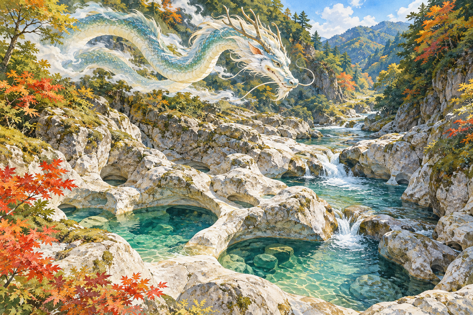
    Imagined dragon deity above river potholes, painted as a Japanese folklore scene
    AI-generated illustration: an imagined interpretation of the rain-dragon tradition, not a photograph or an accurate depiction of the site.

    1. Reading the landscape at Yakama

    A protected riverbed in Yanadani

    Ehime Prefecture records Yakama as a nationally designated Special Natural Monument, designated on March 29, 1952, and managed by Kumakogen Town. Its location is Yanaigawa, on the Kurokawa, a tributary of the Niyodo River, roughly six kilometers upstream from Ochide. The surrounding river basin is known as Yanadani Canyon and forms part of Shikoku Karst Prefectural Natural Park. These details establish its place within the region’s protected landscapes. Ehime Prefecture’s cultural-property record

    The prefecture describes more than thirty potholes in a riverbed section about 25 meters wide and 65 meters long; the largest reaches 12 meters in diameter. Whirling water has hollowed the hard chert. Five groups reflect changes in the river’s course as water levels changed. One group contains eight hollows aligned along the left bank, offered as a possible origin of the name Yakama, or “eight cauldrons.” The name therefore does not mean that there are only eight potholes altogether. Geology and the possible name origin

    Looking beyond a single photograph

    From a safe, permitted viewing position, first take in the arrangement of the river and rock. Then look for smaller details: the relationship between neighboring hollows, the curves of their edges, and the places where water passes between them. Thinking in this order helps turn an unusual shape into a landscape you can read. A close photograph alone can lose the sense of scale that makes the whole formation interesting.

    The tourism association records names including Tunnel, Lion, and Spectacles for individual cauldrons. Such names offer another exercise in looking: a familiar object or creature becomes a way to remember an unfamiliar shape. You do not need to identify every named hollow to appreciate the site, and no photograph is worth stepping beyond a safe viewing area. Kumakogen Tourism Association’s Yakama guide

    Flowing water and sculpted pale rock basins at the actual Yakama Pothole Group
    The actual Yakama Pothole Group. Photo: ball banban, Wikimedia Commons, CC BY 3.0. Uncropped; resized for display.

    2. The dragon deity and the request for rain

    The local tourism association recounts a tradition that a dragon god, or ryūjin, lived at Yakama. People are said to have prayed there for rain. If rain did not come, the story continues, they put metal objects, which the deity disliked, into the pools to provoke its anger and bring rain. This is a reported legend; the page does not establish when it originated or document a particular historical performance. The rainmaking tradition recorded by the tourism association

    What the story invites us to consider

    One way to read the tale is as a story about dependence and uncertainty. Its sequence begins with a request and moves toward confrontation when the desired response fails to arrive. The imagined resident of the pools has preferences, emotions, and the power to answer. That interpretation comes from the structure of the story; it should not be mistaken for evidence about the beliefs of every person who lived in the valley.

    For a traveler, the legend adds questions to the view. What happens when water becomes a presence that can be addressed? How does a deep hollow in a river become a place where a community imagines an encounter? Those questions do not require a supernatural explanation of the potholes. They make room to consider how a landscape can be both a physical formation and the setting for a remembered narrative.

    The two official sources have different strengths. The prefectural record is the source for the designation and geological description. The tourism association is a direct source for how the tradition is presented to visitors today, while its account of earlier rainmaking is a retelling. Neither supplies proof of a dragon deity or enough evidence to reconstruct an ancient ceremony. Keeping those distinctions clear allows the story to remain vivid without turning uncertainty into invented history.

    Today, the appropriate way to engage with this tradition is to read it, discuss it, and observe the river respectfully. Do not throw metal, coins, offerings, or any other objects into the pools, and do not attempt to reenact the tale. Leaving the setting intact is part of making it available to the next visitor.

    3. Planning the descent and the return

    Allow time for the uphill half

    The tourism association warns that water and fallen leaves make parts of the steep path slippery. Its published walking estimates are about twenty minutes down and thirty minutes back up. It lists the location as Yanaigawa and a drive of one hour thirty-five minutes from Kumakogen Town Hall. Treat these as planning references, not promises for your own pace or travel conditions. Official access information and path warning

    As practical planning advice, reserve additional time for resting, looking, and taking photographs. Decide whether everyone in your party can comfortably manage the ascent before starting down. A downhill approach can make the beginning feel easier than the return will be. If someone needs a level or step-free outing, seek specific accessibility advice from the tourism association before choosing this walk.

    Wear footwear with dependable grip, carry drinking water, and keep a hand free where balance matters. Check the forecast and current local access information before departure, especially after substantial rain. Follow signs and barriers on arrival. If the route or river conditions appear unsafe, changing the day’s plan is a reasonable decision. The rainmaking legend is a subject for reflection, never a reason to seek out hazardous weather.

    Choose a season, then check the day

    The association highlights Yakama’s cooling atmosphere in summer and foliage in autumn. These are useful seasonal themes rather than guarantees of a particular temperature, leaf color, or water level on your visit. Seasonal description of Yakama

    For photography, plan around the available safe viewpoints. A wider composition can show how the hollows fit within the riverbed; a closer frame can emphasize an edge or curve. Stop walking before looking through a camera or phone. Keeping the equipment packed during awkward sections of the path helps preserve attention for your footing. Leave enough daylight and energy for the climb back instead of using all your time at the water.

    Wooded mountains near Yakama in October 2014, with a stone marker and temporary barrier in the foreground
    Historical view of the Yakama vicinity, October 2014. The barrier shown does not indicate current access conditions. Photo: r18 INO (PACHIMO), Wikimedia Commons, CC BY 3.0. Uncropped; resized for display.

    4. Giving Yakama a place in a Kumakogen journey

    Kumakogen’s official overview groups Yakama with other sights in the Yanadani area, including Nakatsu Hanamomo no Sato and Izugatani. That regional grouping is useful when choosing a theme for a trip, but it does not establish walking distance or a convenient single-day circuit. Consider the following as separate driving extensions, checking the roads and time required for the route you actually intend to use. Kumakogen’s regional overview

    Flowering trees, beech woodland, and open ridges

    For a spring-focused journey, Nakatsu’s Hanamomo no Sato provides a different subject: ornamental peach trees. The tourism association traces the planting to a couple who began with forty trees in 2008 and gives early to mid-April as the usual viewing period. Check that year’s flowering information before building a trip around blossom. Pairing the two places would let you consider a landscape shaped by planting alongside one shaped by river action.

    Izugatani is introduced through its beech forest, within a specially protected part of a nature conservation area. It offers a woodland theme for further exploration. Consult local guidance for appropriate access and routes; its listing should not be read as permission to enter any part of the forest freely.

    Elsewhere in the same municipality, Okawamine offers a broader mountain setting. The official guide lists an elevation of 1,525 meters and describes connected, bamboo-grass-covered ridges, seasonal flowers, and autumn grasses. Views toward surrounding mountains depend on the weather. This can be a separate upland excursion for travelers who want to balance the enclosed river setting with more open scenery.

    Choose an extension that suits your season and available time, then work backward from the drive and walking effort. A satisfying day does not require fitting every name on the regional map into one schedule. Spending longer at Yakama may offer more than a hurried sequence of distant stops, particularly when the return climb already deserves a generous margin.

    For another water-related narrative after the trip, JAPAN ESSENCE’s Lake Towada legend article provides related reading. Towada is in northern Honshu, a different region from Ehime in Shikoku; it is not a nearby excursion or an additional episode of Yakama’s story. Keeping each tale connected to its own place is part of appreciating Japan’s local traditions.

    Sources and further reading

    Ehime Prefecture: Yakama Pothole Group — official designation, location, geology, scale, and possible name origin.

    Kumakogen Tourism Association: Yakama Pothole Group — the association’s account of the legend, named hollows, seasonal descriptions, and published access guidance.

    Kumakogen Tourism Association: About Kumakogen — regional orientation. Separate destination pages: Hanamomo no Sato, Izugatani, and Okawamine.

    Location map: open the Yakama map linked by Ehime Prefecture. The official map points to 33.524750, 132.992833. Follow local signs for the approach path; this map is not walking-route guidance.

    About the author: JAPAN ESSENCE Editorial Team
    Our mission is to bring you Japan’s legends, myths, festivals and living traditions, through both historical fact and the stories passed down over generations.

  • The Sacred Deer of Nara: Messengers of Kasuga Taisha Shrine

    The Sacred Deer of Nara: Messengers of Kasuga Taisha Shrine

    In Nara City, Nara Prefecture, the deer of Nara Park are woven into the city’s landscape and the traditions of Kasuga Taisha Shrine. Their story brings together a white-deer legend, a historic shrine and the everyday responsibility of sharing space with wild animals.

    Two sika deer in Nara, photographed in August 2018
    “Deer of Nara, Japan; August 2018 (07)” by Steffen Flor, CC BY-SA 2.0, via Wikimedia Commons. Resized for display.

    Introduction to the Sacred Deer of Nara

    FACT: The Deer of Nara Park

    Nara’s free-roaming deer are designated a national natural monument. They are wild animals, even when they approach people. The Nara City Tourism Association explains their protected status and gives guidance for visitors.

    LEGEND: The Origin of the Sacred Deer Tradition

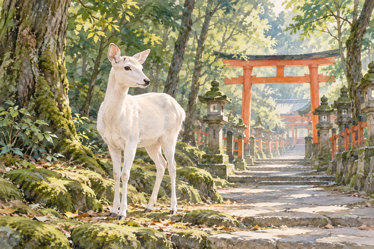
    According to the tradition described by the Japan Tourism Agency, Takemikazuchi-no-mikoto came from Kashima Jingu in present-day Ibaraki Prefecture on a white deer and arrived at Mt. Mikasa. The story connects the deer with the protection of the ancient capital. It is a religious tradition, rather than a documented journey.

    AI-generated illustration of a white deer beside a woodland shrine path
    AI-generated illustration inspired by the white-deer tradition of Kasuga Taisha; not a historical reconstruction or documentary photograph.

    The Legend of Kasuga Taisha Shrine and Mt. Mikasa

    FACT: Establishment of Kasuga Taisha Shrine

    Kasuga Taisha dates its foundation to 768, when Fujiwara-no-Nagate established its shrine buildings under Empress Shōtoku’s direction. Its vermilion columns and white walls stand against surrounding woodland. The shrine’s own history distinguishes its foundation from the older account of the deity’s arrival.

    LEGEND: Takemikazuchi’s Arrival at the Sacred Mountain

    In the shrine’s account, Takemikazuchi dwells on the summit of Mt. Mikasa, called Ukigumo-no-mine. Here, Mt. Mikasa refers to the sacred 御蓋山. Keep that name distinct from the broader Kasugayama Primeval Forest when reading maps and descriptions. Follow posted access restrictions around sacred areas.

    Nara Park, November 2016 - Leaves in autumn in Nara Park
    “Nara Park, November 2016” (Leaves in autumn in Nara Park) by Martin Falbisoner, CC BY-SA 4.0, source, via Wikimedia Commons

    Living Treasures: The Deer of Nara Park Today

    FACT: Respecting Wild Deer

    The deer mainly eat plants growing in the park. If you choose to feed them, use only shika senbei, the special deer crackers. Keep paper, maps and plastic bags out of their reach. Looking approachable does not make a deer tame. Read the tourism association’s guidance before your visit.

    The Historic Deer Antler-Cutting Ceremony

    FACT: The Tradition and the 2026 Dates

    The Nara Deer Preservation Foundation dates Shika no Tsunokiri to 1672, when antler cutting began to reduce injuries. The ceremony starts with a prayer for safety. Its schedule moved from October to November in 2025; the announced 2026 dates are November 7 and 8 at the Roku-en antler-cutting grounds within Kasuga Taisha’s precincts. There is no October event in 2026.

    Dates and arrangements may change, and severe weather can cause cancellation. Check the organizer’s current notice before making a special trip. The event is one part of Nara’s continuing effort to live alongside its deer.

    Nara Park - panoramio (2) - Ukimi-dō (Nara)
    “Nara Park – panoramio (2)” (Ukimi-dō (Nara)) by Feri88, CC BY 3.0, source, via Wikimedia Commons

    Planning Your Visit to Nara City and Kasuga Taisha

    FACT: Visitor Guidelines for Nara Park

    Avoid touching or teasing the deer, and take particular care around males in autumn. Adults should supervise children. If you do feed deer, do not keep them waiting with crackers held in front of them; show empty hands when you have finished. Observing from a distance is a good way to enjoy the park too. Visitor guidance.

    The path to Kasuga Taisha passes through Nara Park. JNTO’s shrine guide gives approximate walking times of 30 minutes from Kintetsu Nara Station and 45 minutes from JR Nara Station, with buses also available. Allow extra time for stops and check current transport information.

    Locator map of Japan highlighting Nara Prefecture
    Nara Prefecture highlighted in Japan; this map does not pinpoint Nara City. Source: Map of Japan with highlight on 29 Nara prefecture.svg; Map: Lincun (color revision by TAKASUGI Shinji), CC BY-SA 3.0, via Wikimedia Commons

    Regional guide

    Location: Nara City, Nara Prefecture

    Sources

    Event information checked on October 7, 2026. Photo credits and licenses appear below each image.

    About the author

    JAPAN ESSENCE Editorial Team
    Our mission is to bring you Japan's legends, myths, festivals and living traditions, through both historical fact and the stories passed down over generations.

  • Miho no Matsubara: Exploring Japan’s Legendary Pine Grove and Mount Fuji Views

    Miho no Matsubara: Exploring Japan’s Legendary Pine Grove and Mount Fuji Views

    Miho no Matsubara in Shizuoka City, Shizuoka Prefecture, is a place where natural beauty and cultural heritage intertwine, offering visitors a glimpse into Japan’s rich tapestry of legends and landscapes. This coastal area is not only a feast for the eyes but also a profound cultural site that tells stories of celestial beings and ancient traditions.

    Miho no Matsubara Pine trees, Shizuoka city, Sizuoka pref, Japan
    “Miho no Matsubara 14” by Motokoka, CC BY-SA 4.0, via Wikimedia Commons

    Introduction to Miho no Matsubara and Its UNESCO Heritage Status

    FACT: Scenic Beauty and Cultural Significance

    Miho no Matsubara is a seven-kilometre seashore lined with pine trees, designated a National Place of Scenic Beauty in 1922 and added to the UNESCO World Cultural Heritage as part of the Fujisan Cultural Site in 2013. This stretch of coastline is renowned for its stunning views of Mount Fuji, making it a popular destination for both tourists and locals alike. The designation as part of the Fujisan Cultural Site underscores its significance not only for its natural beauty but also for its cultural and spiritual importance in Japanese history. Visitors to Miho no Matsubara can experience this unique blend of nature and culture, where the majestic presence of Mount Fuji serves as a backdrop to the tranquil pine grove, creating a picturesque scene that has inspired artists and poets for centuries.

    FACT: The Pine Grove’s Natural Splendor

    The pine grove at Miho no Matsubara features approximately 54,000 pine trees along its seven-kilometre stretch, contributing to its status as a prominent scenic attraction. These trees create a serene and picturesque environment that invites visitors to take leisurely strolls while enjoying the fresh sea breeze. The sheer number of pines, with their whispering needles and the gentle sway in the coastal winds, provide a tranquil backdrop that enhances the spiritual ambiance of the area. Walking through this grove, one can feel a deep connection to nature, with the sound of the waves mingling with the rustle of the pines, offering a moment of peace and reflection.

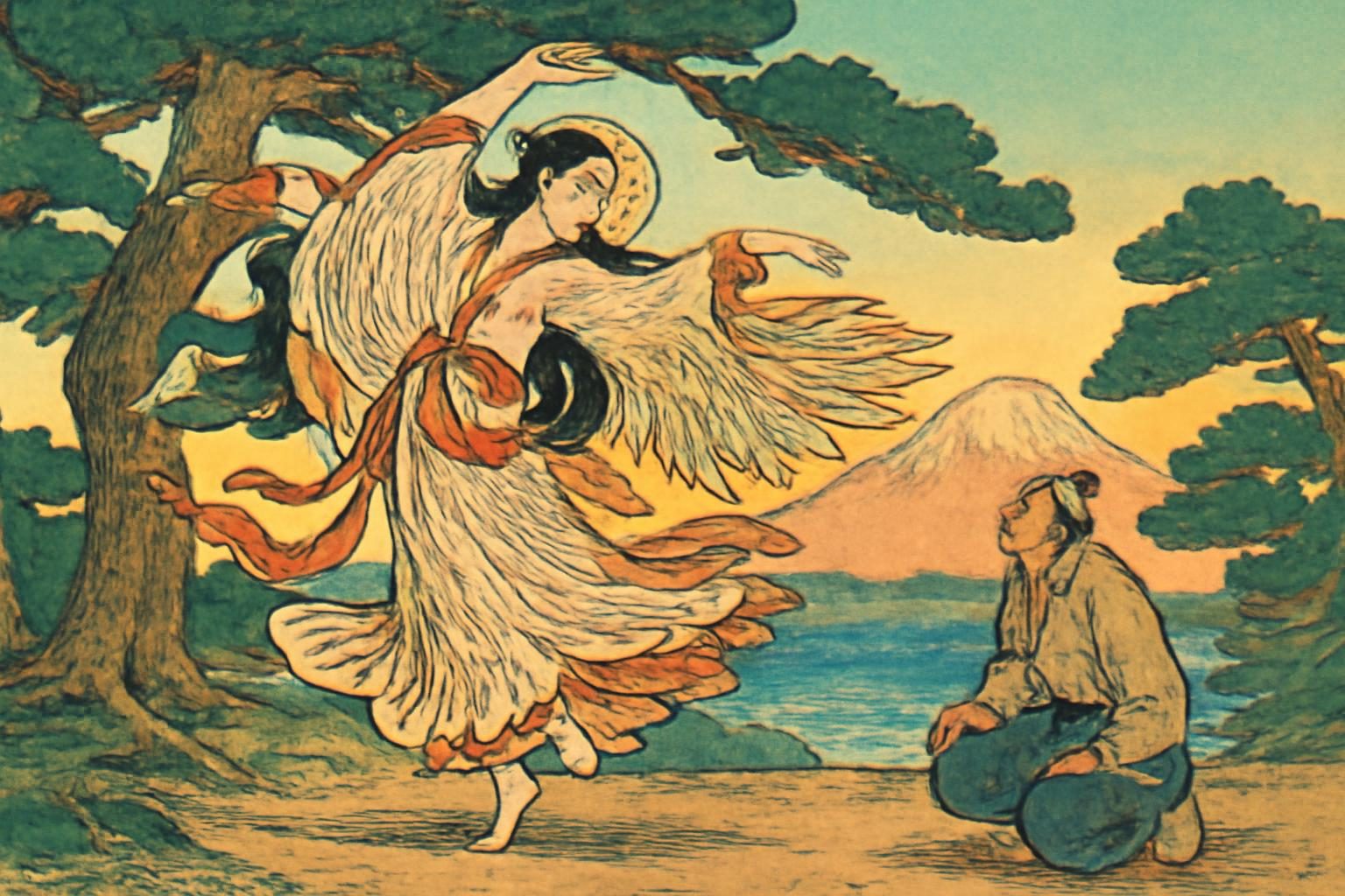
    Celestial maiden's dance by pine tree with Mount Fuji backdrop in ukiyo-e style.
    AI生成イメージ / AI-generated illustration (not a photograph of the actual place)

    The Legend of the Feathered Robe and the Hagoromo no Matsu Pine

    LEGEND: The Celestial Maiden’s Tale

    According to local legend, a celestial maiden descended to Miho no Matsubara, hung her feathered robe on a pine tree, and was only able to retrieve it after performing a celestial dance for the fisherman Hakuryō. This enchanting story, passed down through generations, is celebrated in the Noh play ‘Hagoromo,’ which remains one of the most-performed Noh plays today. The narrative speaks to themes of longing, beauty, and the intersection between the divine and the earthly, capturing the imagination of all who hear it. The legend is not just a story but a cultural touchstone that reflects the values and beliefs of the region, illustrating the deep connection between the people and their natural surroundings.

    FACT: Hagoromo no Matsu and Miho Shrine

    The pine grove includes an ancient tree known as Hagoromo no Matsu, estimated to be around 650 years old, which is symbolically linked to the legend. This venerable tree stands as a living testament to the legend, its gnarled branches and sturdy trunk embodying centuries of history and myth. Nearby, Miho Shrine preserves a piece of the celestial maiden’s feather garment according to local lore, further cementing the area’s connection to this enduring tale. The shrine itself is a place of quiet reflection and reverence, where visitors can contemplate the legend’s significance and its place in the cultural tapestry of Japan. The presence of the feather garment relic adds a tangible element to the legend, allowing visitors to feel a direct connection to the story and its mystical origins.

    Miho no Matsubara 13 - Miho no Matsubara
    “Miho no Matsubara 13” (Miho no Matsubara) by Motokoka, CC BY-SA 4.0, source, via Wikimedia Commons

    Connection to Traditional Noh Theatre and the Hagoromo Festival

    FACT: The Noh Play ‘Hagoromo’

    The Noh play ‘Hagoromo’ is set in the pine grove of Miho, Suruga Bay, and is based on the 8th-century Tango Fudoki. It remains a significant cultural element associated with Miho no Matsubara, reflecting its legendary narrative and continuing to captivate audiences with its timeless themes. The play’s delicate movements and haunting music echo the ethereal beauty of the legend, drawing audiences into a world where the boundaries between the mortal and the divine blur. Attending a performance of ‘Hagoromo’ offers a profound insight into Japanese cultural heritage, where the art of Noh brings to life the ancient stories that have shaped the identity of the region.

    FACT: The Hagoromo Festival

    Every October, on the second Saturday and Sunday, the Hagoromo Festival is held at Miho no Matsubara. This event includes performances of the Noh drama near the legendary pine and associated rituals, drawing visitors who wish to experience this unique cultural celebration firsthand. The festival is a vibrant display of traditional arts, with the Miho Hagoromo Takigi Noh and Miho Children’s Noh bringing the legend to life against the backdrop of the storied pine grove. It is a time when the community comes together to honor their heritage, and visitors can immerse themselves in the cultural richness of the region. The festival not only celebrates the legend but also serves as a reminder of the enduring power of storytelling in preserving cultural identity.

    Exploring Miho Shrine and Local Cultural Relics

    FACT: Miho Shrine’s Significance

    Miho Shrine plays a crucial role in preserving the cultural heritage of Miho no Matsubara. It is said to house a piece of the celestial maiden’s feathered garment, offering a tangible connection to the legend and serving as a place of reverence for those who visit. The shrine’s tranquil setting and historical artifacts provide a deeper understanding of the area’s spiritual significance, allowing visitors to connect with the past in a meaningful way. As a site of pilgrimage, Miho Shrine invites contemplation and respect, offering a spiritual journey that complements the physical beauty of the surrounding landscape.

    Car park in Miho no Matsubara - COVID-19 pandemic in Shizuoka prefecture, Miho no Matsubara
    “Car park in Miho no Matsubara” (COVID-19 pandemic in Shizuoka prefecture, Miho no Matsubara) by Indiana jo, CC BY-SA 4.0, source, via Wikimedia Commons

    Global Legacies: The Monument to Madame Hélène Giuglaris

    FACT: A Tribute to Madame Hélène Giuglaris

    A monument to Madame Hélène Giuglaris stands above the pine grove. Beneath it lies a lock of her hair, fulfilling her wish to be buried near the Hagoromo pine despite never having visited Miho in life. This monument highlights the global impact of the legend and its ability to inspire individuals from diverse backgrounds. Madame Hélène, a French dancer, was so moved by the story of the celestial maiden that she wished to be eternally connected to the site, demonstrating the universal appeal and emotional resonance of the legend. Her tribute is a testament to the power of art and storytelling in bridging cultural divides, fostering a shared appreciation for beauty and myth.

    Locator map of Japan: Shizuoka City, Shizuoka
    Legend site: Shizuoka City, Shizuoka — Source: Map of Japan with highlight on 22 Shizuoka prefecture.svg; Map: Lincun, CC BY-SA 3.0, via Wikimedia Commons

    Regional guide

    Location: Shizuoka City, Shizuoka Prefecture

    • Souvenirs and confections featuring celestial maiden imagery (Shimizu Ward) — source
    • Monument to Madame Hélène Giuglaris (Shimizu Ward) — source

    Sources

    About the author — JAPAN ESSENCE Editorial Team. Our mission is to bring you Japan’s legends, myths, festivals and living traditions, through both historical fact and the stories passed down over generations.

  • Visiting Jōren Falls: Shizuoka’s Legendary Spider Woman Waterfall

    Visiting Jōren Falls: Shizuoka’s Legendary Spider Woman Waterfall

    Jōren Falls, located in Izu City, Shizuoka Prefecture, is renowned not only for its breathtaking natural beauty but also for the captivating legend of the Jorōgumo, a mythical spider woman said to inhabit the falls.

    A mystical waterfall scene inspired by Japanese folklore, with mist, silhouettes, and lanterns creating an enchanting atmosph
    AI生成イメージ / AI-generated illustration (not a photograph of the actual place)

    Introduction to Jōren Falls in Shizuoka Prefecture

    FACT: A Natural Monument and Top Waterfall

    Jōren Falls is situated in the Yugashima district of Izu City, nestled within the lush landscapes of Shizuoka Prefecture. This stunning waterfall is part of the upper reaches of the Kano River and has been designated as a Shizuoka Prefectural Natural Monument. It is also celebrated as one of “Japan’s Top 100 Waterfalls,” making it a must-visit destination for nature enthusiasts and travelers alike. The combination of its majestic cascade and the verdant surroundings creates a serene and picturesque setting that captivates visitors year-round.

    The recognition as a top waterfall underscores the aesthetic and ecological value of Jōren Falls. Visitors can experience the tranquility of the cascading waters, which flow down a height of approximately 25 meters, creating a mesmerizing spectacle. The sound of the water crashing into the pool below adds to the immersive experience, making it a favored spot for those seeking solace in nature.

    FACT: Geological Significance

    Jōren Falls is not only a site of natural beauty but also of geological importance. It lies within the Izu Peninsula Geopark, a Global Geopark recognized for its unique volcanic geology. The area features fascinating lava flows and columnar joints, offering visitors a glimpse into the dynamic geological history of the region. These geological formations provide insight into the volcanic activity that shaped the landscape, making Jōren Falls a point of interest for both geologists and tourists interested in the natural sciences.

    The Izu Peninsula Geopark’s designation highlights the significance of preserving the area’s geological features. Visitors to Jōren Falls can observe the intricate patterns formed by the cooling and solidification of lava, which are a testament to the powerful natural forces that have sculpted the terrain over millennia. This geological backdrop enhances the allure of the falls, providing a deeper understanding of the natural world.

    The Legend of the Jorōgumo Spider Woman

    LEGEND: The Enchanting Spider Woman

    According to Japanese folklore, Jōren Falls is the dwelling place of a Jorōgumo, a mythical spider that can transform into a seductive woman. This creature is said to lure unsuspecting men to their doom with her beauty and charm. The legend of the Jorōgumo adds an element of mystery and allure to the already enchanting setting of Jōren Falls. The story is a classic example of Japanese yokai folklore, where supernatural beings often interact with humans, sometimes with dire consequences.

    The Jorōgumo legend is deeply rooted in the cultural imagination, reflecting themes of deception and transformation. The spider woman’s dual nature symbolizes the duality of beauty and danger, a common motif in folklore. Visitors to Jōren Falls can sense the eerie yet fascinating aura that the legend imparts, enriching their experience of this natural wonder.

    LEGEND: The Tale of the Woodcutter

    One popular version of the legend tells of a woodcutter who accidentally dropped his axe into the pool beneath the falls. A beautiful woman emerged from the water to return his axe, but she made him promise to keep their encounter a secret. However, the woodcutter could not resist sharing his story at a banquet, and as a consequence, he died in his sleep, presumably ensnared by the Jorōgumo’s web. This tale serves as a cautionary story about the importance of keeping one’s word and the potential dangers of revealing secrets.

    The woodcutter’s tale underscores the moral lessons often found in folklore, emphasizing the value of discretion and the perils of breaking promises. It also highlights the Jorōgumo’s cunning nature, as she uses the woodcutter’s own actions against him. This narrative invites reflection on human behavior and the supernatural consequences that folklore suggests can follow.

    LEGEND: The Spiderweb Trap

    Another tale recounts how a Jorōgumo attempted to ensnare a man by wrapping his leg in spiderwebs. The man cleverly transferred the web to a nearby stump, which was then pulled into the water, revealing the true nature of the Jorōgumo’s trap. These stories have merged over time to form the famous lore specific to Jōren Falls, captivating the imaginations of locals and visitors alike. The narrative of the Jorōgumo is a testament to the rich tapestry of Japanese folklore, where human ingenuity often plays a role in overcoming supernatural challenges.

    This story of the spiderweb trap illustrates the theme of wit and resourcefulness triumphing over malevolent forces. It serves as an allegory for overcoming adversity through cleverness and quick thinking, resonating with audiences who appreciate tales of human triumph against supernatural odds.

    Izu Joren-Wasserfall 09 - Joren Falls
    “Izu Joren-Wasserfall 09” (Joren Falls) by Zairon, CC BY-SA 4.0, source, via Wikimedia Commons

    Exploring the Surrounding Landscape and Wasabi Fields

    FACT: The Wasabi Fields of Izu

    Adjacent to Jōren Falls are fields dedicated to the cultivation of Izu wasabi, a renowned specialty of the region. The traditional Tatami-ishi style of wasabi cultivation is practiced here, adding to the cultural and natural heritage of the area. These wasabi fields not only provide a picturesque backdrop to the falls but also contribute to the local economy and culinary traditions. Visitors to the area can witness the meticulous process of wasabi cultivation, which involves maintaining the delicate balance of water flow and nutrient-rich soil, essential for growing high-quality wasabi.

    The presence of these wasabi fields enhances the visitor experience, offering a unique glimpse into the agricultural practices that define the region. The Tatami-ishi method, characterized by its stone-lined beds, is a testament to the ingenuity and tradition of local farmers. This method not only ensures optimal growing conditions but also preserves the natural beauty of the landscape, making it a harmonious addition to the Jōren Falls area.

    Planning Your Visit to Jōren Falls

    Visitors to Jōren Falls can enjoy the serene beauty of the waterfall while immersing themselves in the rich folklore and cultural heritage of the region. The combination of natural splendor and mythical intrigue makes Jōren Falls a unique destination that offers both relaxation and a touch of mystery. Whether you’re drawn by the allure of the Jorōgumo legend or the tranquility of the surrounding nature, Jōren Falls promises an unforgettable experience. The area is accessible for day trips, and the nearby wasabi fields offer an additional layer of cultural exploration, making it an ideal spot for those looking to delve into the natural and mythical wonders of Japan.

    Planning a visit to Jōren Falls allows travelers to engage with the multifaceted attractions of the area. From the captivating legends to the geological marvels and cultural landscapes, the falls offer a comprehensive experience that appeals to diverse interests. Whether exploring the stories of the Jorōgumo or savoring the flavors of local wasabi, visitors are sure to find a rich tapestry of experiences awaiting them at Jōren Falls.

    Izu Joren-Wasserfall 06 - Joren Falls
    “Izu Joren-Wasserfall 06” (Joren Falls) by Zairon, CC BY-SA 4.0, source, via Wikimedia Commons
    Locator map of Japan: Izu City, Shizuoka
    Legend site: Izu City, Shizuoka — Source: Map of Japan with highlight on 22 Shizuoka prefecture.svg; Map: Lincun, CC BY-SA 3.0, via Wikimedia Commons

    About the author — JAPAN ESSENCE Editorial Team. Our mission is to bring you Japan’s legends, myths, festivals and living traditions, through both historical fact and the stories passed down over generations.